Crossing Val Travenanzes, Ampezzo Dolomites
Enrico Tiziano Belli
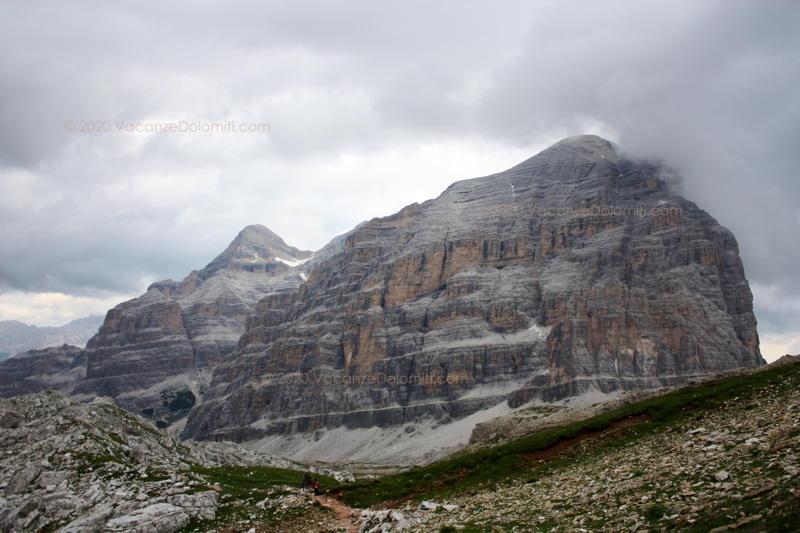
I had travelled through the Val Travenanzes valley when I was a boy: a beautiful valley, with something wild. I remember herds of mountain goats (or chamois?) and marmots everywhere. On the right the Tofane, with their view from the rear, not the one that faces Cortina d’Ampezzo. On the other side, the Torri di Fanes, Monte Ciaval, and the Croda del Valòn Bianco.
These peaks are impossible to see from Cortina and perhaps for this reason they are new and strange: fairytale-like.
There was every good reason to nurture the secret desire to take my family there, with all 5 of my children. So one morning on a hot summer’s day in July I announced: tomorrow we are taking the cable car and climbing up to Piccolo Lagazuòi.
“How long is Val Travenanzes, dad?”
“Where are we going, Daddy?” Usual question. To Val Travenanzes, I answer. But how long are we going to walk? Just another usual question. Not much (I knew I was lying). For the records, at the time of the excursion, in my family, apart from my wife and myself, there was a 17-year-old, a 15-year-old, an 11-year-old, an 8-year-old girl and a 4-year-old boy.
Not for beginners
The valley is very beautiful but rather long and it is advisable to evaluate your own strengths well. In this post I’m telling you about how I took even very young children, but it has to be said that my kids all started walking in the Dolomites since they were two years old, in uphill hikes with differences in altitude of even 800 -1,000 meters. I am certainly not inviting beginners to venture into this hike without adequate training.
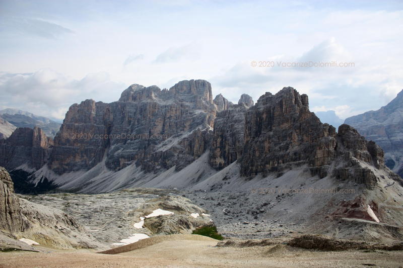
Having said that, we take the cable car to the Falzarego Pass and in a few minutes we go up to the Piccolo Lagazuòi. From here, the view extends to the Marmolada, Pale di San Martino, Civetta, Pelmo, Antelao and Sorapìss. To the north, we admire the peaks of Fanes and Tofane, the great Lagazuòi and the Scotoni peak.
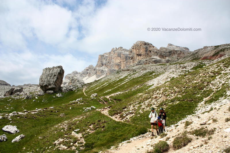
After Forcella Travenanzes col there are marmots!
We go down towards Forcella Travenanzes col and we walk through the area of Austrian posts during the Great War, with lookout points carved into the rock and with loopholes facing south, towards the Italian side.
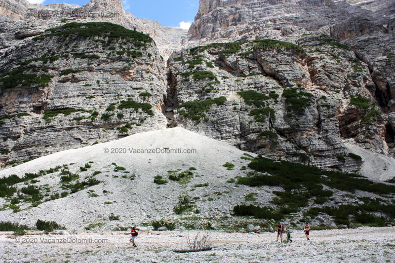
From Forcella Travenanzes col ( 2,507 m), trail 401 descends into the valley. A marmot area: several marmots can be seen and approached quite closely. A very exciting moment for the kids.
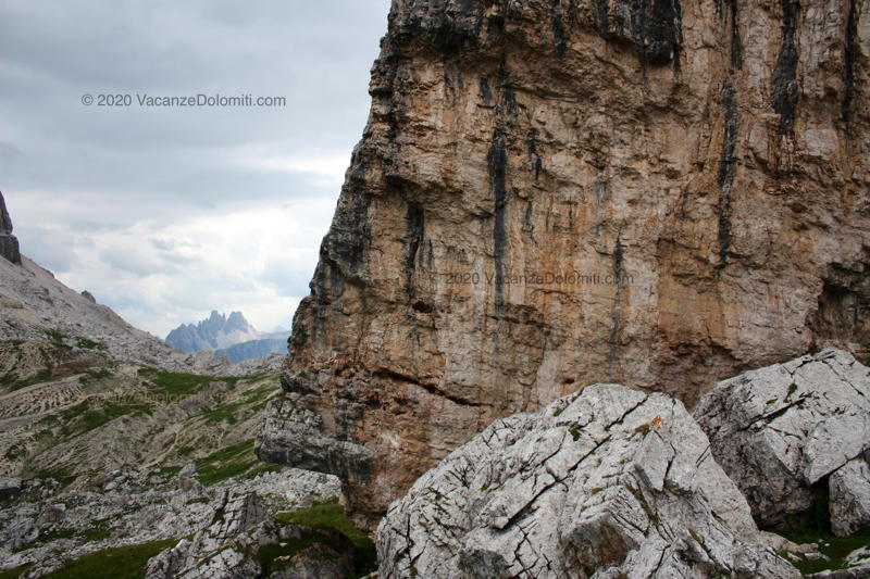
Better than the Grand Canyon
From this point onwards we begin to enter one of the many open-air museums in the Dolomites. Along the way we will go from an altitude of 2,700 m. to an altitude of 1,300 m., with a view of very different rock layers. I find some erratic boulders placed with unlikely inclinations along the trails or in the middle of green meadows very poetic. Signs of the ancient presence of glaciers.
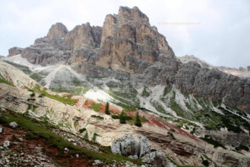
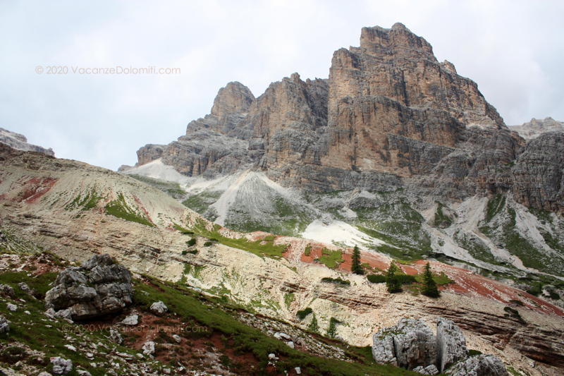
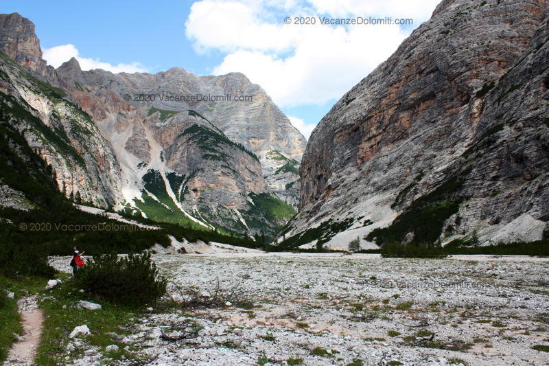
Continuing the descent, around an altitude of 2,300 metres, the view of the lower part of the valley opens up towards the north, which the eye accompanies as far as where the Travenanzes stream leaves its jumps and waterfalls to spread out into a wide, very white, bed of scree. This is the point where the length of the Val Travenanzes can be measured with the eye.
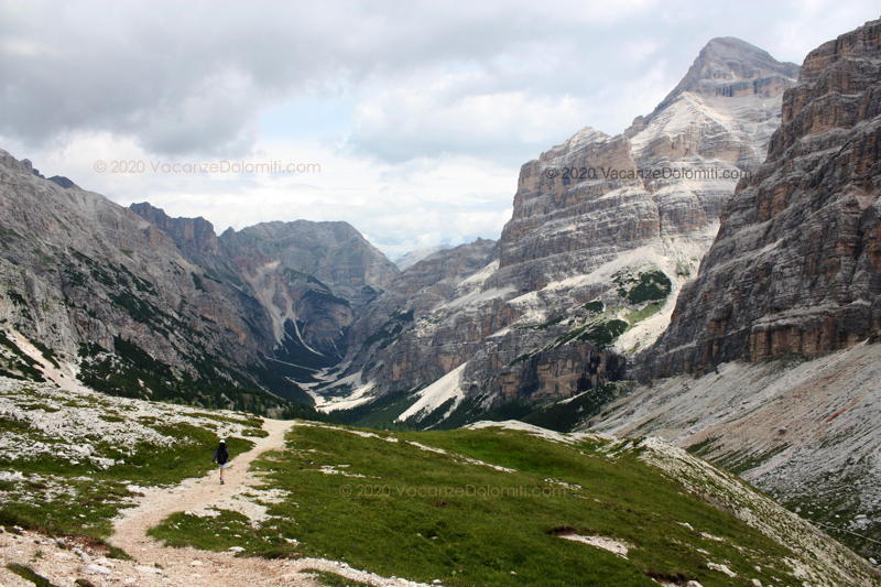
In the distance, the view closes with the Croda del Valòn Bianco. Instead, turning left, towards the west, we notice a sloping ridge, called Terra Rosses, because it lies on layers from which one, of a bright red earth, emerges.
To Casòn de Travenanzes.
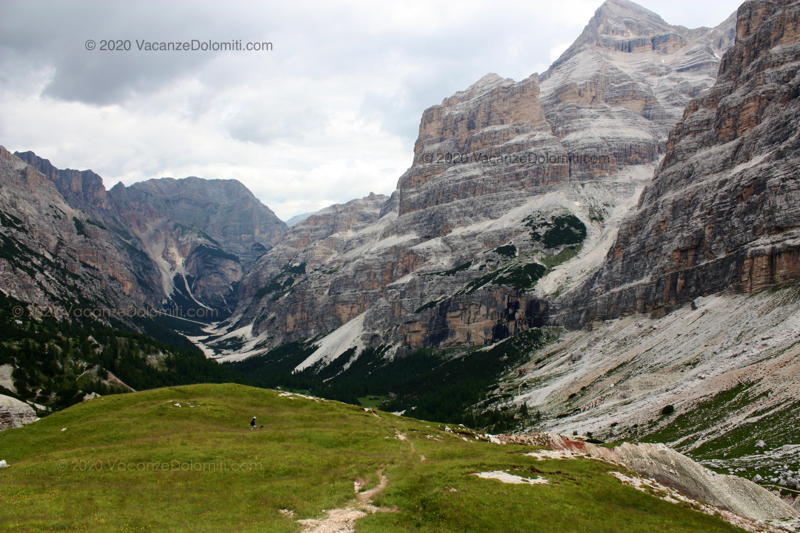
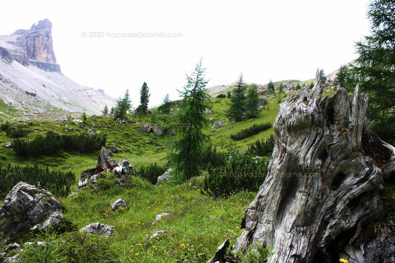
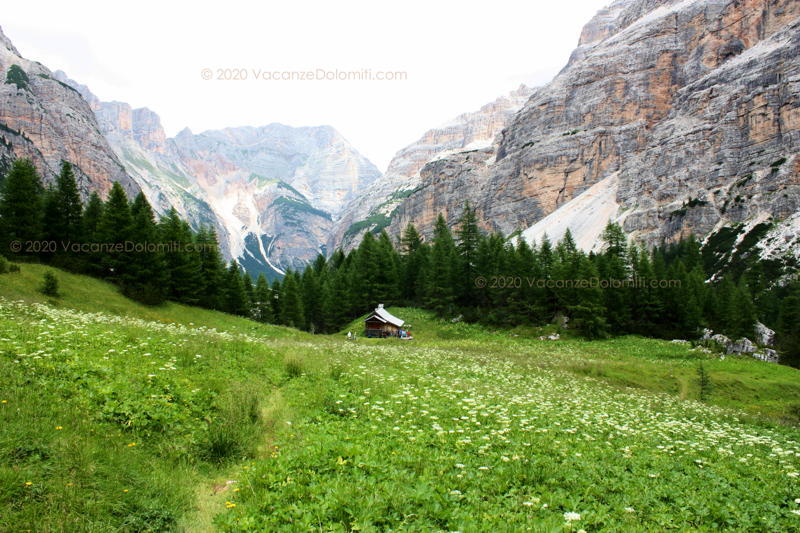
At an altitude of 2,050 metres, after descending to the level of the woods, we take a break at the Casòn de Travenanzes, by the stream. From here we admire the final part of the Ciadin de Fanes, a wide valley that descends from the Piza de Medo.
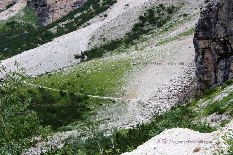
The path continues through the woods, crossing several side streams (good, fresh water) and then descends to the scree bed, crossing the stream at some ford or other.
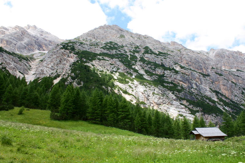
We are still at a high altitude, but the high peaks pour their scree from above along narrow gullies, which appear, from right to left, like large cones of scree that make the Travenanzes stream sometimes bend to the right and sometimes to the left.
We are at the end of the open part of the valley, which now closes and while the stream falls into gorges, the trail continues high along the right side of the valley. Here, next to some gullies we found some landslides that made us carry on very carefully (I made a note of the points at altitudes 1.681 m. and 1.632 m.).
At the bottom of the valley, now in the woods, the adventure is not over. We cross the Cadorìs bridge and the Outo bridge, over gorges of an astounding depth. The last part of the path, in the woods, slopes gently down to the level of the stream, which is now called Ru de Fanes: the Travenanzes stream joined it without being noticed by us hikers, almost secretly, just below the Outo Bridge.
The crossing of the Val Travenanzes valley in brief
We leave a first car at: 2.105 m., Passo Falzarego.
We leave a second car at: 1.320 m., near Felizòn bridge, in Fiames, along road SS 51.
Departure: 2.752 m., Rifugio Lagazuòi hut.
Arrival: 1.320 m., Visitor Centre of the Dolomites Natural Park, near Podestagno Castle.
Difference in altitude: 1.430 m. (in this case downhill).
Time: 7 hours (including breaks).
Difficulty: signposted trail, not particularly difficult, but towards the end there are some parts that need to be tackled with caution.
Trails: 401.
Maps: Sheet 03 – Cortina d’Ampezzo – Dolomiti Ampezzane, published by Tabacco.
Photo galleries: Val Travenanzes: photo gallery on Flickr.
Weather: see the Dolomiti Meteo forecasts.
Last update: July 2020.