The Croda da Lago hike starts from the road between Pocòl and Passo Giau.

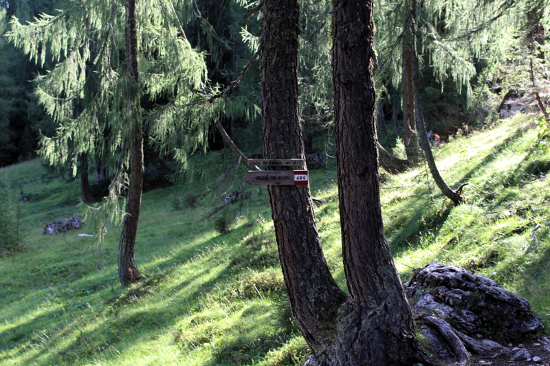
Trail 437
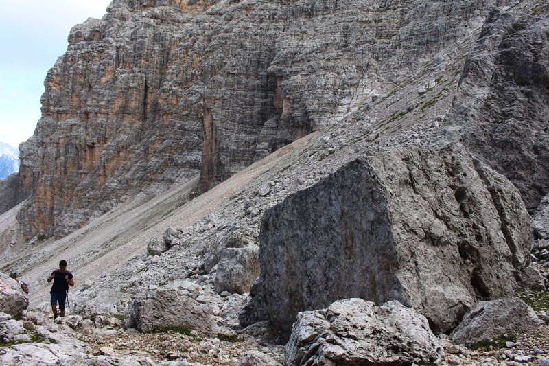
At Ponte de Rucurto bridge take trail 437. After crossing a stream, go into the wood on a gradual slope until you get to trail 434, which descends from the Rifugio Croda da Lago hut and continues towards Pezié de Parù. You are now in Casòn de Formìn, at an altitude of 1.845 m..
Casòn de Formìn
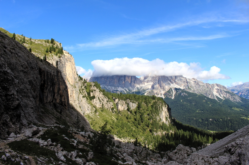
Croda da Lago to Val de Formìn Hike
At this crossroad, take trail 435 instead, which leads into the beautiful Val de Formìn valley and climbs up to Forcella Formìn col.
Val de Formìn
Looking towards the top of the valley, the path bends to the right with continuous changes in scenery: on the left the scree fields descending from Croda da Lago, on the right the first grassy foothills leading to the wide plateau of Lastòi de Formin.
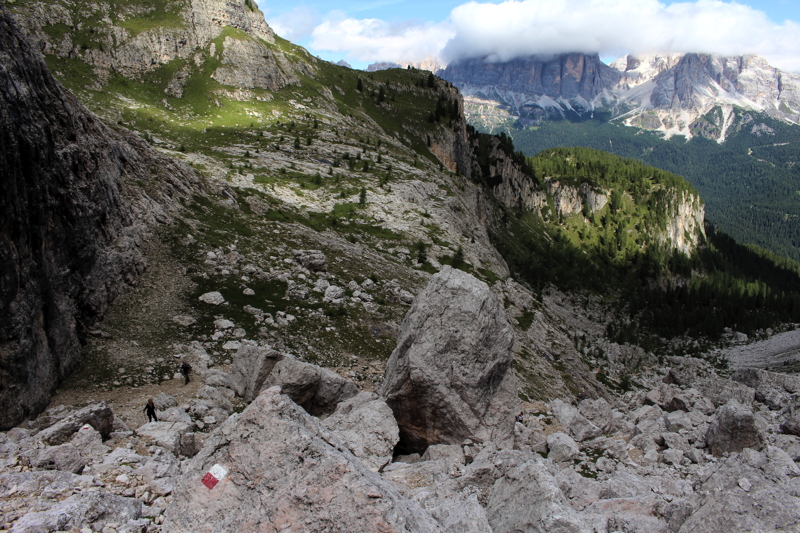
Every now and then stop and turn towards the north: the north-south layout of the valley allows you to enjoy a direct view of the Tofane. And as you climb, the view changes.
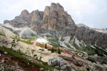
You have almost reached Forcella Formìn col: the path becomes less steep and the view gradually opens onto the incredible Lastòi de Formin plateau.

Croda da Lago hike: from Forcella Formìn col to Rifugio Palmieri hut.
You are now at Forcella Formìn col, 2,462 m.. From here the view stretches to the Tofane, the Lagazuoi, towards the north and, to the south, to Mount Pelmo and, closer on the left, to the Becco of Mezzodì.

Lastòi de Formin. In the distance there are the Torri di Fanes and, on the right, under the cloud, the Tofana di Rozes.
Now continue south along trail 435 in the direction of Forcella Ambrizzola col (2,277 m): just before the col you cross trail 436, which in a short walk takes you to the col.

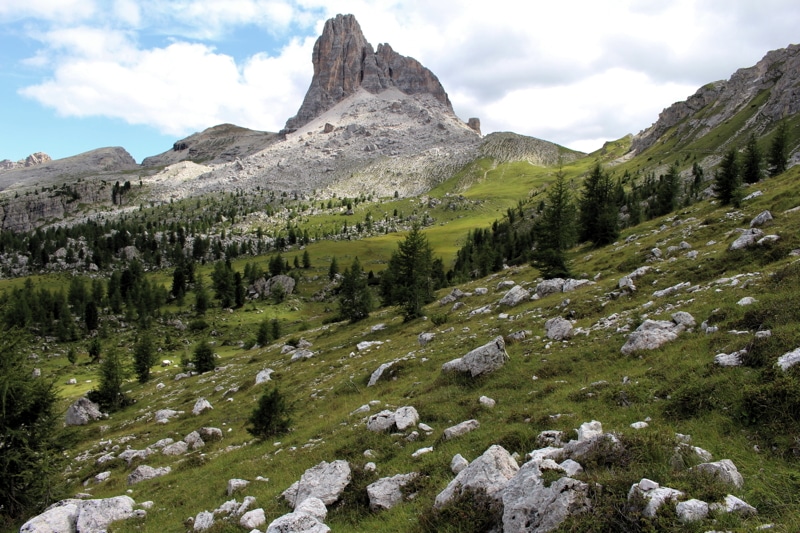
A cloudy Monte Pelmo summit, today. On the left, less towering seen from above, the Becco di Mezzodì.
Here, another change in scenery: the view opens onto the Boite Valley, the Antelao, the Sorapìss group and the Ampezzana basin. Below the grassy glades at the foot of the Croda da Lago, the Lago da Lago and the Rifugio Palmieri hut.

Trail 434 descends from Forcella Ambrizzola col under the watchful eye of Becco di Mezzodì.
From Forcella Ambrizzola col take trail 434 towards Rifugio Palmieri-Croda da Lago and Lago da Lago or Lago Fedèra.
Monte de Fedèra with the Becco di Mezzodì
As you descend, the small Becco di Mezzodì comes into view, gradually losing its appearance as a small peak when seen from above, rising instead to dominate the grassy plateau known as Monte de Fedéra.

Pastures at the foot of the Croda da Lago. In the background, on the right, the Cristallo.
From Rifugio Palmieri hut (2,046 m) continue along trail 434 in a northerly direction and descend towards Ponte de Rucurto bridge. At a certain point you will return to the village of Casòn de Formìn that you went to in the morning: at this point leave trail 434 and instead take trail 437 again, which takes you back to your car.
The Croda da Lago hike at a glance
- Departure: from Ponte de Rucurto bridge (1.708 m), on road SP638 of Passo Giau, between Pocòl and Passo Giau (click to view the starting point on google maps).
- Arrival: 2.462 m., Forcella de Formìn col.
- Difference in altitude: 754 m.
- Return: via Forcella Ambrizzola col (2,277 m.), Rifugio Palmieri-Croda da Lago hut (2,046 m).
- Time: 2 hours uphill (3 hours with children). A total of 8-9 hours.
- Difficulty: medium.
- Trails: 437, 435, 436, 434 and finally 437 again.
- Maps: Sheet 03 – Cortina d’Ampezzo – Dolomiti Ampezzane, published by Tabacco.
- Photo gallery: Photo gallery of this hike on Flickr
- Children: it is a very beautiful hike without any dangerous parts; however, due to the great difference in altitude and the significant distance, it would be advisable to only bring children and youngsters who are already trained in walking.
- Weather: see the Dolomiti Meteo forecasts.
- Last update: July 2018.